Publications
 Partners


New York - Some 400km above the Earth, a flock of shoebox-size Dove satellites is helping to change our understanding of economic life below.
In Myanmar, night lights indicate slower growth than World Bank estimates. In Kenya, photos of homes with metal roofs can show transition from poverty. In China, trucks in factory parking lots can indicate industrial output.
Images from these and other satellites, combined with big- data software, are helping to create what former Nasa scientist James Crawford calls a “macroscope” to “see things that are too large to be taken in by the human eye.” Aid organisations can use the results to distribute donations. Investors can mine them to pick stocks.
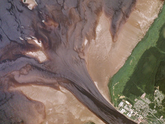
Onega River Delta, Russia, July 19, 2014: A Planet Labs satellite captured this image of exposed mud flats along the southeastern shore of Russia’s Onega Bay. (Photo: www.planet.com)
“This is one of those really rare game changers that come along very infrequently but has the ability to remake the whole stock- and economic-research industry,” said Nicholas Colas, chief market strategist at Convergex Group, a New York-based brokerage. “We still make monetary policy in this country based on surveys of a few thousand households and businesses.”
For much of the nearly six decades since Sputnik first circled Earth, satellites have mainly been the exclusive domain of the richest governments and companies, costing billions and weighing tons. Now cheap orbiting cameras are becoming more ubiquitous.
Planet Labs, a San Francisco start-up founded in a garage by former Nasa engineers, has one of the largest-ever constellations. More than 50 of its Doves orbit the Earth every 90 minutes, snapping high-resolution photographs that image most of the planet each day.
EXPLORE: Planet labs website
Seattle-based BlackSky Global, backed by Microsoft Corp. co-founder Paul Allen’s Vulcan Capital, plans to start launching its fleet of 60 satellites next year to scan most of the globe 40 to 70 times a day.
Millions of photos are useless, of course, until they become data. That transformation is the goal for start-ups such as San Francisco-based Spaceknow. Chief Executive Officer Pavel Machalek says imagery eventually will track all the world’s trucks, ships, mines and warehouses to attain what he calls “radical economic transparency.”
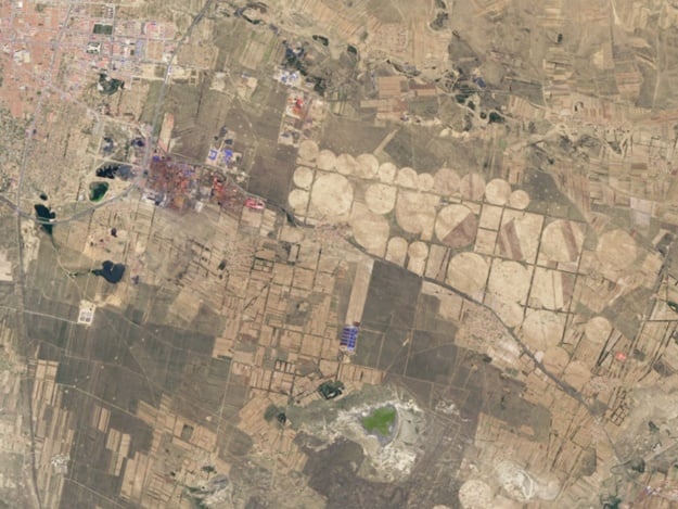
Ulanqab, Inner Mongolia, China, June 2013 above and July 5 2014 below: Rapid development of the area around Qitai town in Shangdu County, Ulanqab, is evident from the changing land use: New buildings, farms, and expansion of blue roofs near the pond, which house livestock.
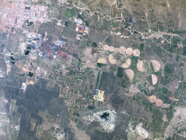
He created an index of China factory production using algorithms to monitor more than 6 000 industrial facilities, hoping to supplant survey-based purchasing-manager indexes with software that identifies signs of economic activity, such as transport vehicles in parking lots.
His China Satellite Manufacturing Index fell to 46.9 in May, below the 50.2 reading for the government’s China Manufacturing PMI. Readings above 50 signal expansion.
Orbital Insight founder Crawford says he wants to create the “macroscope” that will alter the world as microscopes did centuries ago.
The Palo Alto, California, company uses advanced image processing and algorithms to track national and global trends. One product estimates sales at 60 US retail and restaurant chains. Others generate a global poverty map and predict illegal deforestation by watching for road construction and other signs of logging.
Customers include hedge funds, banks, government agencies, nonprofit organisations and Fortune 500 companies — “anyone who needs to understand the world at scale to make decisions,” said Crawford, who led the team that created the daily activity planners for Nasa’s Mars rovers.
Orbital has received funding from Bloomberg Beta, a venture-capital unit of Bloomberg LP.
These technologies are breathing new life into economics, where policy is driven by information-gathering techniques dating back to the 1940s. Now images can be processed into statistics available in days, not months, and even old data can reveal new answers.
WATCH: Meet the "doves" behind the photos
Declassified US Air Force weather-satellite imagery dating back to the 1970s has allowed economists to measure the brightness of cities at night. This proxy for economic activity is leading them to re-examine estimates for global inequality and growth in developing countries.
In Myanmar, one of the smallest and poorest after a half- century of military rule, World Bank data show expansion averaged 10% for more than a decade. Lights glowing across the Southeast Asian nation told a different story to Brown University economists, who concluded the luminosity implied an average of 3.26%.
Xavier Sala-i-Martin, a professor at Columbia University in New York, used the same night-light data to question World Bank estimates that 30% of the globe lives in poverty. He says satellite photos suggest the percentage is just 6%.
“It’s a big debate in my field,” Sala-i-Matin said. “That’s why it was important for me to find a referee. Let’s have an independent measure.”
He and Maxim Pinkovskiy, an economist at the Federal Reserve Bank of New York, found poverty is lower and decreasing faster than surveys indicate. Luminosity data show growth has been higher in poor countries, developing-economy living standards have risen faster and world-income distribution has become more equal, they said in a January report published by the bank.
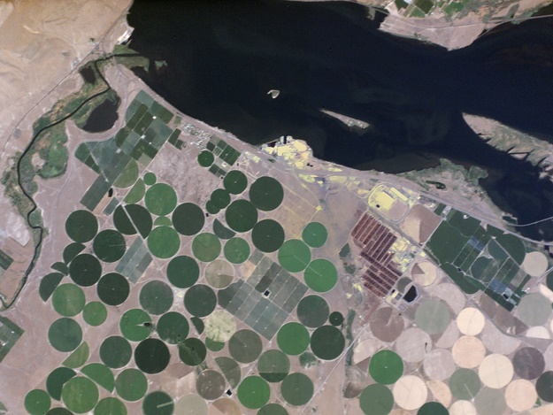
Walla Walla County, Washington, USA, July 28, 2014: Just south of the confluence of the Snake and Columbia rivers, the McNary National Wildlife Refuge is home to one of the highest concentrations of waterfowl in North America. It covers the marshy area to the left and most of the river at the top of the image, surrounding the fields of rural Burbank.
While satellite data do have “a lot of promise,” Andrew Dabalen, a lead economist for the World Bank’s Poverty Global Practice, says Sala-i-Martin and Pinkovskiy’s conclusions haven’t been verified. Lights are associated more with industry, making them less reliable for measuring activity in rural and agricultural areas, Dabalen added.
“It can help fill the gaps, but it’s not a substitute for having face-to-face data collection directly from households,” he said. World Bank researchers are looking at new ways to pair satellite data with statistics from census surveys to better infer income or consumption. “It’s not perfect, but you can get a rough idea how the poor and rich are distributed across space in a country.”
Tavneet Suri, an associate professor of applied economics at the Massachusetts Institute of Technology in Cambridge, is using a similar strategy to study housing conditions for her native Nairobi, Kenya. In the city’s Kibera slum, she combined surveys from researchers visiting homes with satellite photos that show structures and upgrades such as new metal roofs.
“If you’re trying to do policy effectively,” she said, “you need to understand what poverty and wealth look like.”
GiveDirectly, a New York-based charity that makes payments to the extremely poor in Kenya and Uganda, uses satellite photos to help determine who gets donations. Families in structures with thatched roofs are more likely to receive funds than people in sturdier buildings.
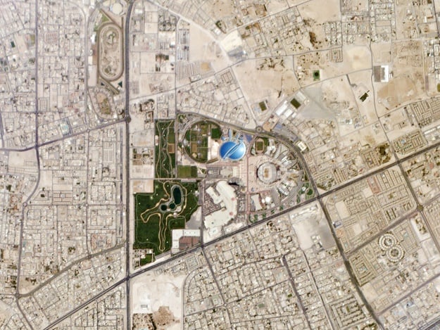
Aspire Zone, Qatar, 16 days ago: Doha’s Aspire Zone, an existing multi-purpose sports complex, was central to Qatar’s bid to host the 2022 Men’s World Cup tournament. The complex is currently undergoing renovations—part of a massive project to construct nine new stadiums (and thousands of luxury hotel rooms) in Qatar.
Despite recent advances, satellite images may never be able to provide data for essential economic indicators such as inflation or employment, much less for more-abstract gauges such as consumer confidence or lending rates. Even the ability to count every car in every Wal-Mart parking lot in North America several times a day can’t show how much anyone spent. Conclusions depend on how observable visual data correlate with actual levels of income and consumption.
Satellite data also aren’t catching on with the US government, even if defence and intelligence agencies have some of the best orbiting cameras in the world. Spokesmen for the Labor Department’s Bureau of Labor Statistics and Commerce Department’s Bureau of Economic Analysis said they don’t use this information and don’t plan to, without explaining why.
WATCH: Planet Labs' Will Marshall on Ted Talks
Wall Street isn’t waiting. Rich Abbe, who helps oversee about $100m as co-founder of Iroquois Capital Management in New York, was intrigued enough by analysis from Remote Sensing Metrics that he bought a stake in the closely held Chicago-based company and started using its tools to inform his trading.
He says he likes that its data are objective, and not everyone has access. Recently he used its reports on parking-lot totals to take positions in consumer companies such as Chipotle Mexican Grill and JC Penney. And he sees more possibilities in other industries — from mining and commodities to oilfields and rigs — now that he has “an interesting macro view.”
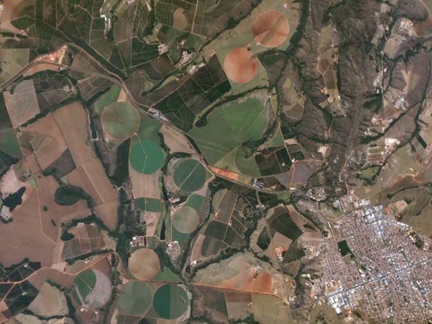
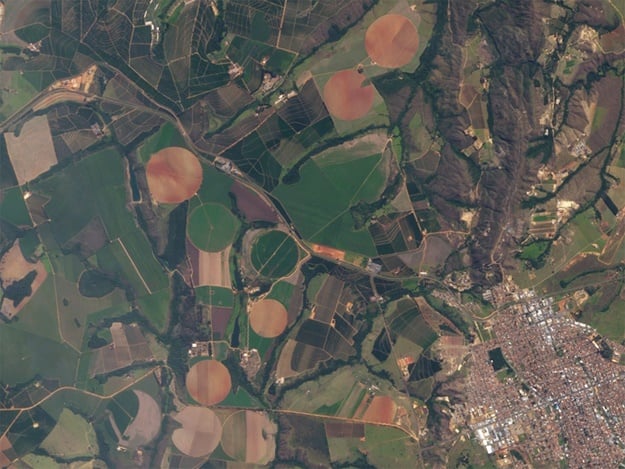
Patrocínio, Minas Gerais, Brazil, July 28 2013 above and July 7, 2014 below: Cattle and soybeans are the main economic activities in Patrocínio, in the Paranaíba River basin. It is part of the Cerrado, a tropical savanna biome that extends through the states of Goiás and Minas Gerais in Brazil. The World Wide Fund for Nature named it the most biologically rich savanna in the world.